AMNESTY DECODERS
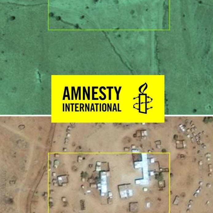
A satellite image processing platform designed to support Amnesty International’s human rights violation research. It’s used to compare recent satellite images of Darfur villages with older ones to determine where man-made destruction have been perpetuated in remote villages in Darfur.
The Decode Darfur application is a satellite image processing crowdsourcing platform. It is designed to support Amnesty International’s human rights violation research by identifying and geo-locating systematic man-made destruction perpetuated in remote villages in Darfur.
28,600
Volunteers
6,438
Decoders
326,066
Square km decoded
The application was launched in October 2016 that engaged over 30,000 digital volunteers who contributed over 10,000 hours of work (equivalent to someone working full-time for over 4 years) to identify and map over 326,000 square kilometers of satellite images of remote and vulnerable villages in Darfur. The digital volunteers were then asked to compare high-definition satellite images of the identified villages but taken at different time periods. The purpose was to look for evidence of attacks by helping identify significant changes in buildings and structures over time (e.g. intact villages in the before picture and burnt villages in the after picture). Using a desktop or phone, users were asked to compare recent satellite images of Darfur villages with older ones to determine where damage had occurred in the past two years.
Implementation year: 2016, 2017
Explore Further
IN PARTNERSHIP WITH